The Eyre Peninsula

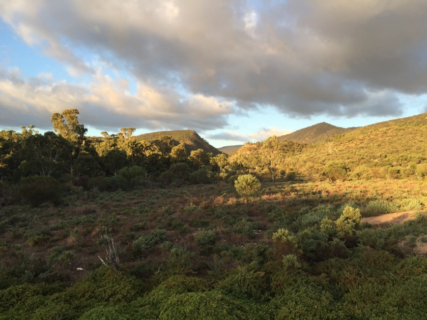
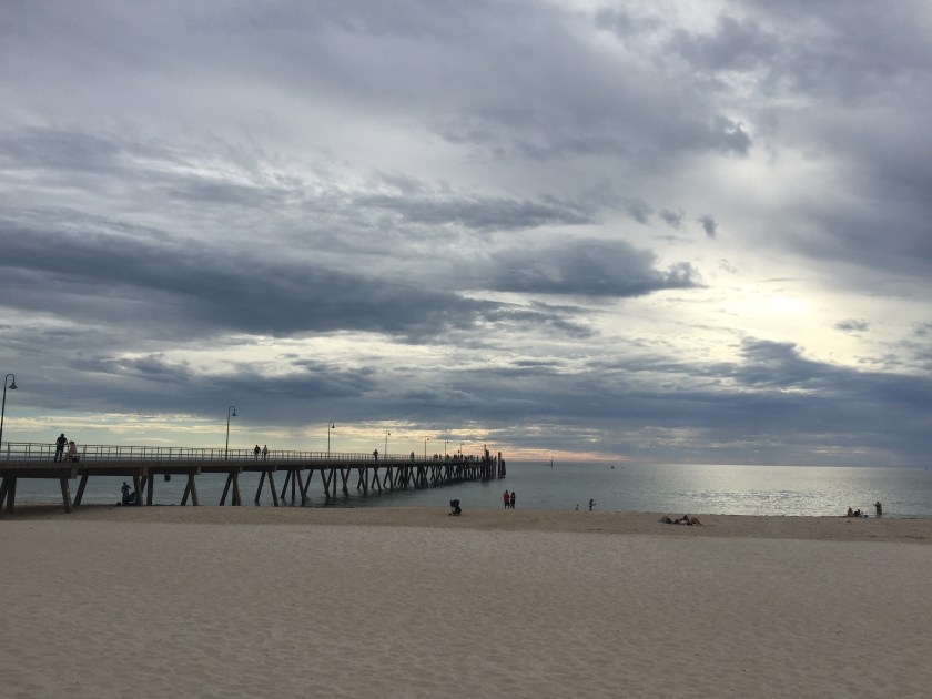
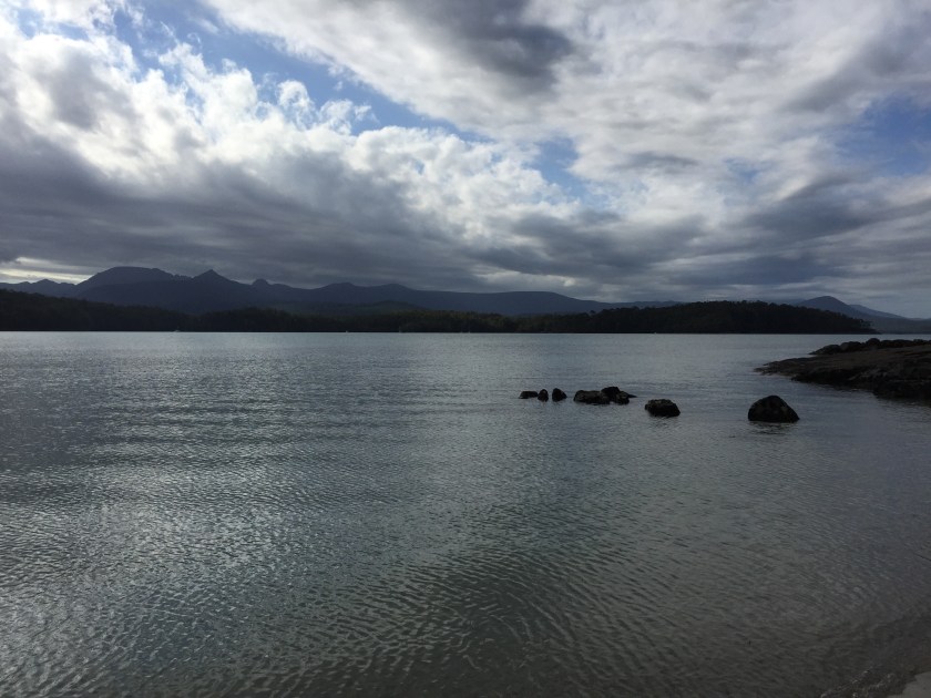
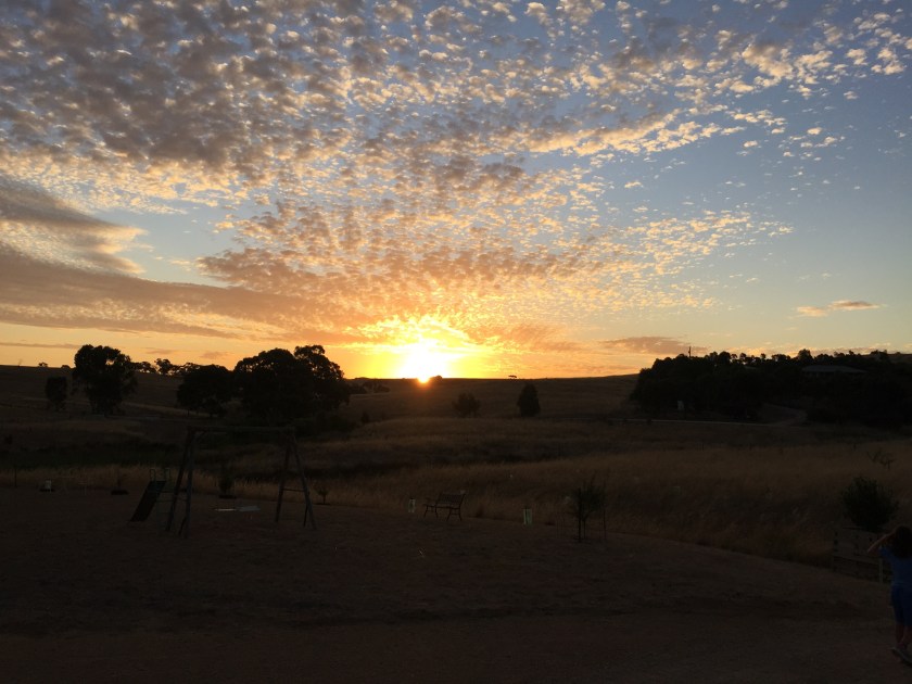
Sometimes the loveliest places aren’t in the guide book and Arno Bay, halfway down the east coast of the Eyre Peninsula, is one of them.  With a shop, a post office, a playground, a pub, a caravan park and a jetty, Arno Bay has everything you need without the crowds.  Population: 500.  The main occupation seems to be fishing.

image
Lee getting ready to ride the dune

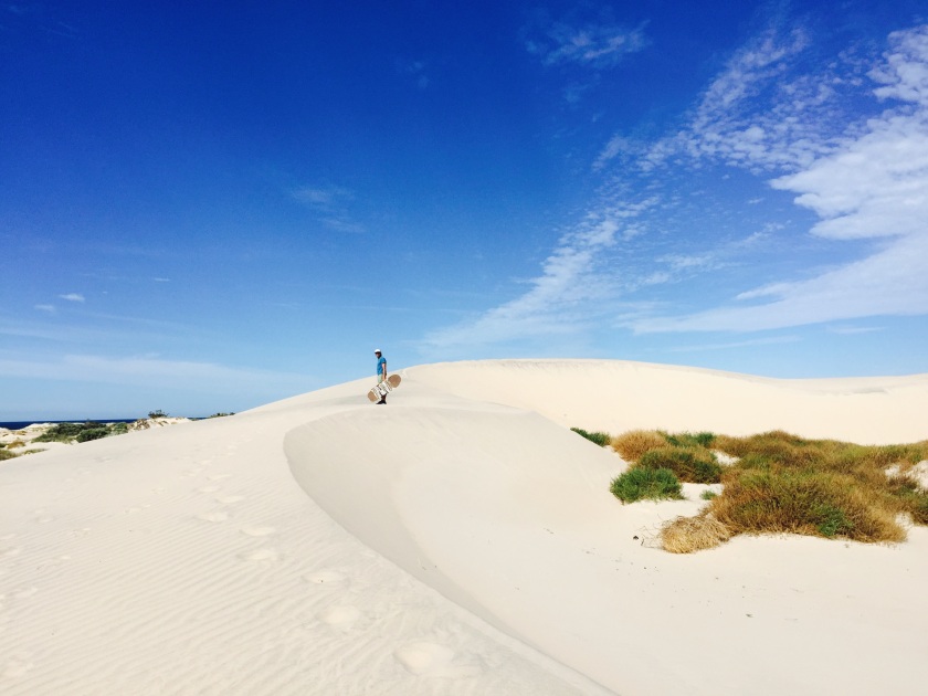
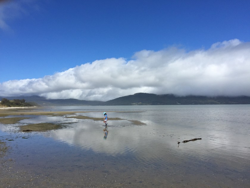
The man at the front desk of this friendly park lent us sand boards and told us where to go sandboarding on the dunes at Point Gibbon.  He also mentioned we may see some sea lions.  I wasn’t holding my breath.  Scientists estimate that there are only about 14,700 Australian sea lions left in the world—they were hunted nearly to extinction in the 19th century. 

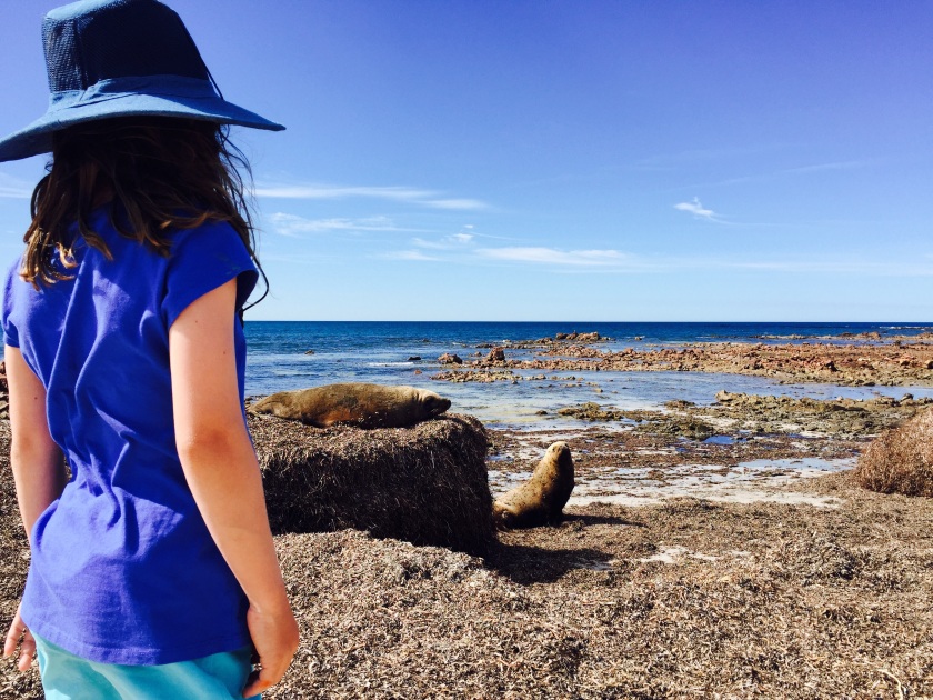
After some exhilarating rides down the dunes, I wandered over to the rocky point with R, and, sure enough, right in front of us was a large brown Australian sea lion, basking on a rock in the sun.  Then we saw two more.

I turned around and waved my arms to get K’s attention—she and Lee were a hundred meters away and would never be able to hear me shout over the sounds of the sea.  I signed “sea lion, here”.  K ran over and we watched them for a while before the three large creatures ambled awkwardly into the water, “walking” on their back flippers, and then diving gracefully into the waves.

image
K with sea lions on the Eyre Peninsula


courtesy of Lizpenfold.com


The Flinders Ranges

image
Mount Remarkable National Park, SA

Mount Remarkable National Park is located 238 kilometres north of Adelaide in the Flinders Ranges.  This mountain range began forming about 800 million years ago, when Australia was still connected to Antarctica and the area was a shallow sea.image

The creeks here are dry in summer and the landscape is hauntingly beautiful.  Massive red river gum trees shine silver in the evening light.  I walked to Hidden Gorge, where jagged orange rock walls rose up around me.  It certainly felt hidden—I didn’t see another soul on the 18 k walk, excepting a few kangaroos and emus.

image
Hidden Gorge, Mount Remarkable National Park


image
Baroota Homestead Ruins

We also visited the Baroota Homestead Ruins, where early pioneers tried their luck at running sheep from the 1850s.  And mostly failed.  First came draught, then floods.  These settlers had been told the area could support 50,000 sheep; realistically, it could only run about 2,200.  We tried to imagine their isolated life: no shops, no doctors and that relentless South Australian heat.

Our stay was comparatively comfortable.  Mambray Creek Campground has hot showers, dishwashing facilities, and flush toilets.  And, after paying for an $85 SA parks pass, we can stay in any national park campsite for no extra charge for two months.  Bargain.  We love South Australia.  They even gave me a library card that I can borrow books on and return them to any SA library along the way.

Next stop: The Eyre Peninsula.


Adelaide

The capital of South Australia has a population of 1.2 million, but everyone insists it’s just ‘a big country town’.  The major grocery stores are open from 11-5 on Sundays and all grocery stores here will be shut for three days over Easter.  The pace is slow; people are friendly.

But it’s HOT.  The beauty of cooking outside in a camp kitchen vanishes when it’s 40 degrees.

We’ve paused in Adelaide for a couple of weeks because K is going to a fabulous school: Klemzig Primary.  It’s public, but it looks like a posh private school.  There’s a new wing, purpose built for deaf students with windows for walls and plenty of space for circular tables.

There are about five other deaf kids in K’s class.  The rest are hearing, but many of them are CODA (children of deaf adults) so Auslan is their first language.  Everyone signs.  The teacher is deaf and signs all day.  K is in heaven.  Many of the lessons include something hands-on—they walked around the school for math the other day, finding things that were odd and even.

Adelaide seems very deaf friendly.  We went to Kids Weekend at Writer’s Week, which was all free, and all the readings under the big red tent were interpreted.  K, who is a voracious reader, sat there, mesmerized (from 9.30-4.30) by author after author talking about the inspiration for their books and reading and just generally being funny in the case of Andy Griffiths.

image
Andy Griffiths

During the day, when Dad’s at work and K’s in school, R and I escape to the Art Gallery of South Australia (my favourite) or the Museum, with its famous giant squid (R’s favourite) or the library, where they’ve given us a temporary library card, all of which are air-conditioned.

And when it gets too hot, we hop in the car of an evening and head to one of the beaches.  Glenelg is pretty, with an amazing playground and a cool sea breeze.  Ahhhh.

image
Glenelg
image
Ethel Wreck, Innes National Park
image
Pandalowie Beach, Innes National Park SA

Last weekend, for the three day weekend, Cup Day (only in Australia do you get a public holiday for a horse race) we drove down to the southernmost tip of the Yorke Peninsula and camped at Innes National Park.  There was a stunning surf beach where we went boogie boarding, but not too far out as it’s a bit ‘sharky’ here.  There were quiet blue bays and ruins of shipwrecks.  It was lovely to get away from the crowded city caravan park.

Next week we’ll leave Adelaide and head west, back to the bush!


Baw Baw National Park

After getting off the boat from Tassie, we visited a dear friend in Wonthaggi, and then kept heading in the wrong direction to the stunning Baw Baw National Park northeast of Melbourne.

From Walhalla, a gold mining town, and at my suggestion, we took a dirt road to the remote (free) campsite, Aberfeldy River.  It was 17 kilometres down a rocky road that hugged a steep mountain.  At some point I looked left out of the window and saw a three hundred meter or more drop down a cliff.  My palms became moist.

Then we got to a place to where the road narrowed and I’m sure Lee and I were both hoping like hell that no one was coming the other way.

Every time I looked out the window and saw the drop, I pictured us falling, trailer and all, down the cliff to the bottom of the valley.  I was so nervous and I wasn’t even driving.

After we’d gone 12 k, we came to a tree in the middle of the road.

image
On the road to Aberfeldy River

image

Thankfully, my husband is prepared for everything.  He brought out a shovel and heaved and hoed until the tree was out of the way.

When we arrived, it was all worth it.  We stayed for three nights on the river.  The days were warm and 23 degrees; the nights were cold and crisp.  We skimmed rocks, built dams and the girls made endless potions.  K and I took a river walk upstream where we skinny-dipped in a swimming hole.  In the evenings sat round the campfire with the guitar, under the stars, all on our own.

image

After three days and nights, we finally drove west–in the right direction–towards the Grampians.

Leaving Tasmania

image

Three weeks is not nearly enough to see this beautiful island, but here we are, boarding the ferry.

We spent our last days at Mt. Field National Park, which boasts a fine campsite (v. cheap) with hot showers! We went on bush walks and explored the Styx River with its massive Swamp Gums, some of them 400 years old.

image
R looking up at s 400 year old Swamp Gum
image
The top of the Swamp Gum
image
Getting on the boat

On on the third day we woke to the smell of smoke–Tassie is experiencing an especially bad fire season.  And R had a fever.

We packed up and drove three hours north, hoping to camp at Bakers Beach.  As we got closer, the smoke grew thicker. Then we saw a helicopter with a bucket of water dangling beneath. That’s when we turned around.  I cursed myself for not checking where the fires were earlier.

We drove through the smoke to Devonport.

On the way, R threw up in the car. We pulled over and cleaned it up as best we could with wet wipes, but she kept saying, as we drove, ‘I can smell vomit.’

In Devonport the smoke was too bad to camp and every motel, hotel and cabin was fully booked.  At six pm, we booked a motel (our first) in Burnie and drove the extra 40 minnutes there.  Lee and I took turns eating in a restaurant. It was bliss to sit there on my own with food someone else had cooked.

R is better now; we’ve cleaned the car and we’re getting on to the Spirit of Tasmania. On the other side, we’ll visit a friend on the Mornington Peninsular before heading west round this big country.


The Southernmost Point in Australia

Cockle Creek is the end of the road in southeastern Tasmania and the furthest south you can drive in Tassie.  You can walk a further seven kilometres to the southernmost point, which Lee and I were lucky enough to do.

image
Lee and the girls at the beach at Cockle Creek
image
Paddy melon on the south coast track to the southernmost point in Australia 

Located within Southwest National Park, Cockle Creek is also, quite possibly, the most beautiful free camp in the world.  Clear calm blue-green waters lap the shores of the vast Recherrche Bay.  Paddymelons hop around the bush at dusk.

The colonial history–like all Tasmanian history–is violent, dark, heart wrenching.  Aborigianls lived here for tens of thousands of years before the Europeans arrived.

What’s interesting is how different the French explorers were from the British.  Of course the French have their dark chapters of colonial history elsewhere on the globe, but when Bruny d’Entrecasteaux arrived on his ship to what is now known as Cockle Creek, he  came to observe.

He took on board with him artists, botanists, zoologists and philosophers.  The French explorers were there in 1792 to gather information about the people, flora and fauna.  They learned and recorded some of the local language and one Frenchman on this trip wrote in his journal (echoing Rousseau) that the locals were, “close to nature . . . whose candour and kindness contrasts so strongly with the vices of civilisation.”

The British, on the other hand, saw Tasmania as the perfect place for a prison.

They came and chopped down thousand year-old Huon pines.  Logging remains a significant industry in Tasmania.

In something that many call genocide, the Aboriginal Tasmanians (except for a few remaining descendants) were wiped out.

And they slaughtered whales in the name of progress, for their precious oil.  It’s hard to imagine those calm blue waters running red with blood and stinking to high heaven with smouldering whale blubber.

image
Recherché Bay

There used to be around 100,000 Right whales.  Now there are 1-2 thousand.  The baleen from the whales was used to keep women corseted half a world away in England.

It makes you wonder about the meaning of the word, “civilised”.


Scenes from Bruny Island

Located in the southeastern tip of Tasmania is the stunning Bruny Island, really two islands, joined by a ‘neck’. There are no grocery stores, just gorgeous views everywhere you look.

image
R on the ferry to Bruny
image
Fairy penguin
image
Echidna
image
Sunset, at Cloudy Bay


image
K at the ‘Neck’ of Bruny, where there is a memorial for Truganini
image
The Neck 

We spent four nights camping in the Bush–just $5 per adult a night and $2.50 for for K.

At the first campsite at the Neck, we met a family who’d been traveling for seven years! They looked surprisingly clean, but they did have a caravan with a shower.

The second site was four wheel-drive only and we had to drive on the beach to get there. Cloudy Bay was gorgeous and we could’ve stayed weeks except for the Blow Flies and the fact that we  ran out of chocolate.

We’re headed for a caravan park in Dover tonight for showers and a shave and the dreaded laundry.  Then, back to the bush!

The Joys of Free Camping

On the way down to Melbourne, via the Great Ocean Road, we went inland and found the perfect free camp at Dando’s.  The sites included picnic tables and fire pits and were set among 200 foot gums growing straight up all around us. There was even a river to swim and fish in.

The next day we did a walk in the treetops, ‘The Otway Fly’ in the rainforest.

image
View from above; the Otway Fly
image
View from my kitchen; free camping in near Lorne, Vic

The next night, we stayed in another free camp, complete with blackberry bushes. See above.

On the 23rd we took the overnight ferry to Tassie.

image
Leaving Melbourne on the Spirit of Tasmania

We found stunning free camping in the Bay of Fires, a rugged part of coastline in northeastern Tasmania, famous for its pounding surf and granite boulders covered in orange lichen.

image
Cosy Corner Campground, Bay of Fires, TAS


Doubling back

Because we had to rush to get to Deaf Games in Adelaide, we decided to go back and see a few sites that we missed. . . And so we drove south on Highway One towards Melbourne. We have a ferry booked for Tasmania on 23 Jan. We’ll spend three weeks there then carry on around Australia clockwise.

First stop: Little Dip Conservation Park.

image
Camping at Little Dip. In South Australia, National Park sites are just $14 a night.
image
View from our campsite

We met a family with three boys who’d just spent nine months going round Australia and were on their way home.  They carried with them less then half of what we had.

They showed us their favourite spots on a well-worn map, mostly off-road. ‘I’m allergic to bichimun,’ the mum said with a glint in her eye. As a child she’d sailed across the ocean to America.

I watched with admiration as she reversed the four wheel wheel-drive with trailer attached. (I haven’t even driven the four wheel-drive yet!) This mum–so enthusiastic, so game–was inspiring.

When I asked about homeschooling she said, ‘Every day? We were lucky to get the school books out once a week!’


Thank you to Lee’s Relatives

We had a lovely two nights with Uncle Bryn and Aunt Susan in Victor Harbour where the girls were spoiled with cakes and ice cream at all times of day.

Thanks also to Lee’s cousin, Helen and family for a visit with chickens and kittens and horses–heaven for K and R.

And thank you to Cousin Fay and family for a night at their beautiful house.

image
Sunset at Fay’s house on Tinpot Road, SA
image
Tinpot Road, near Mount Barker